Blog

  • Ain’t No Canyon Low Enough

    Ain’t No Canyon Low Enough

    Ain’t No Valley Canyon Low Enough

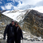
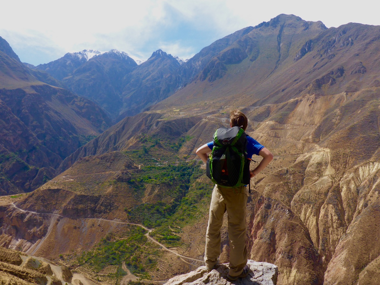
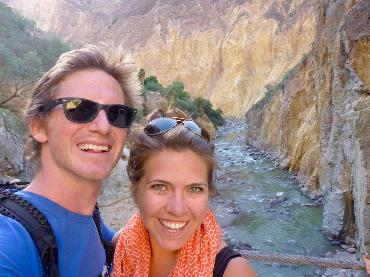
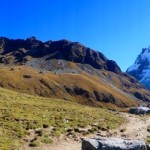
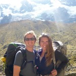
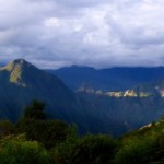
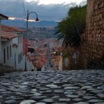
    Peru is home to the world’s deepest and second deepest canyons, both are just outside of Arequipa. We wanted to hike at least one of them, and being of the anti-guided mindset, found Colca Canyon to be more independent traveler friendly with a nice little circuit of small villages about a days hike apart throughout the canyon.

    P1200518
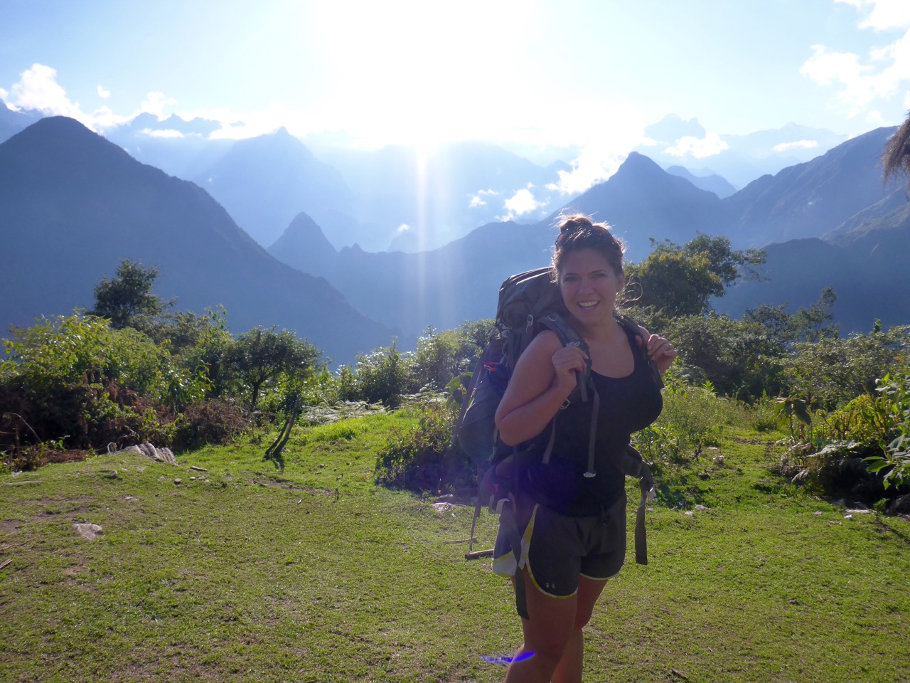
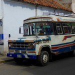
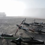
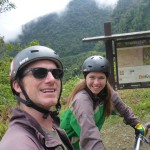
We had heard that the main route from the “larger” town at the canyon rim, Cabanaconde, to the oasis village at the bottom, Sangelle, was pretty packed with tour groups. So we decided to take an alternative route to get off the beaten path. Unfortunately, to get to the canyon rim we had to take a tourist bus. It picked us up at 3:00am and we fortunately were able to sleep for the first couple of hours. But within fifteen minutes of being awake and listening to the guide we were so glad we would be departing from him shortly.

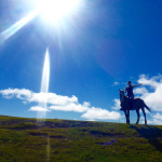
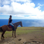
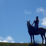
    Once we arrived in Cabanaconde we stopped at Pachamama Hostel to grab a trail map and advice on the alternative trekking options. They were really helpful and we confidently set off on our way. We only made it to the edge of town before we got completely distracted by a horse auction going on in an old bull fighting ring.

    We each picked out which horse we would buy, if we were going to buy a horse in Peru. I chose a big (for a Peruvian horse) bay stallion with a “c” mark on his forehead. Rick picked one of the younger black horses. I struck up a conversation with one of the locals next to us and it was going smoothly until I asked how much a horse would cost… to which he responded “how many horses?”, I said just one, but that clearly was incomprehensible that I would want to buy just one horse. Apparently in the Peruvian countryside you would NEVER buy just one horse, so we talked in circles for a few minutes, then he consulted the folks next to him about the crazy idea of buying just one horse and how much it would cost. The answer was 400 Soles, about $125 US dollars. What a deal!

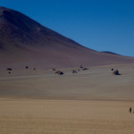
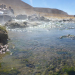
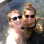
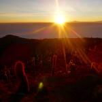
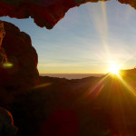
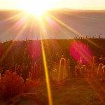
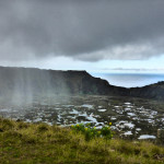
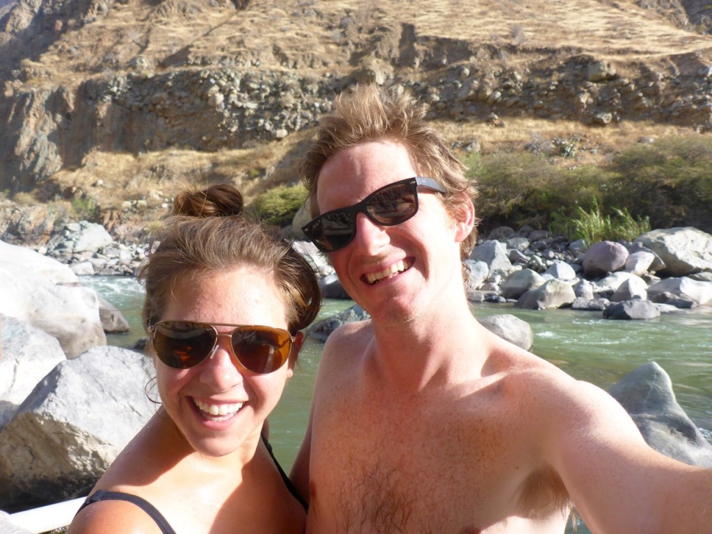
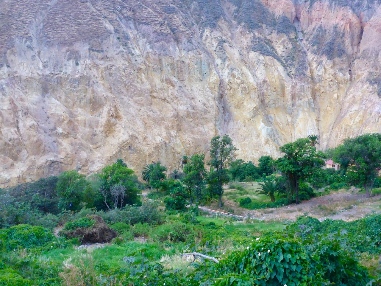
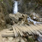
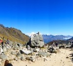
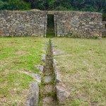
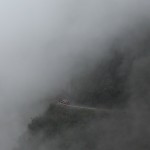
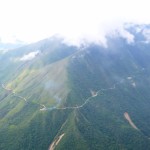
    But horses are difficult to cross borders with so we forced ourselves to leave the auction and start the hike. The first day was mostly downhill into the canyon. We saw lots of cactus and birds, and the condors were the star of the show that day. We saw over a dozen of them soaring over our heads. We were told it was a five hour hike, but we made it in a little under three hours and arrived at Llahaur. Llahaur can’t even be considered a village… it’s really just a spot on the river where a family has erected some bamboo huts and a little restaurant because there are hot springs there. It was adorable and the views were incredible.

    P1200525

    We set down our packs and went straight for the hot springs. We spent most of the afternoon and evening there enjoying the warm water and canyon views. It was, by our low standards, luxury trekking! We got to sleep in a bed, someone else made dinner and there were hot springs – score!

    P1200529

    P1200533

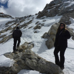
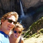
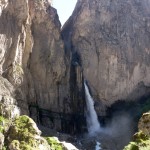
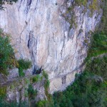
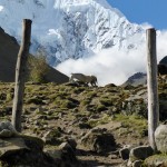
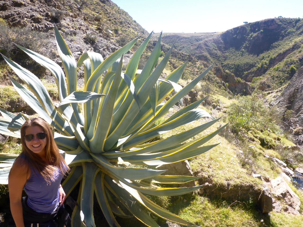
    We woke up refreshed and ready to tackle the uphill hike to the next village, Fure. It was the one that would get us way off the beaten path. Fure is in a lush side canyon, off of the main canyon.P1200554 
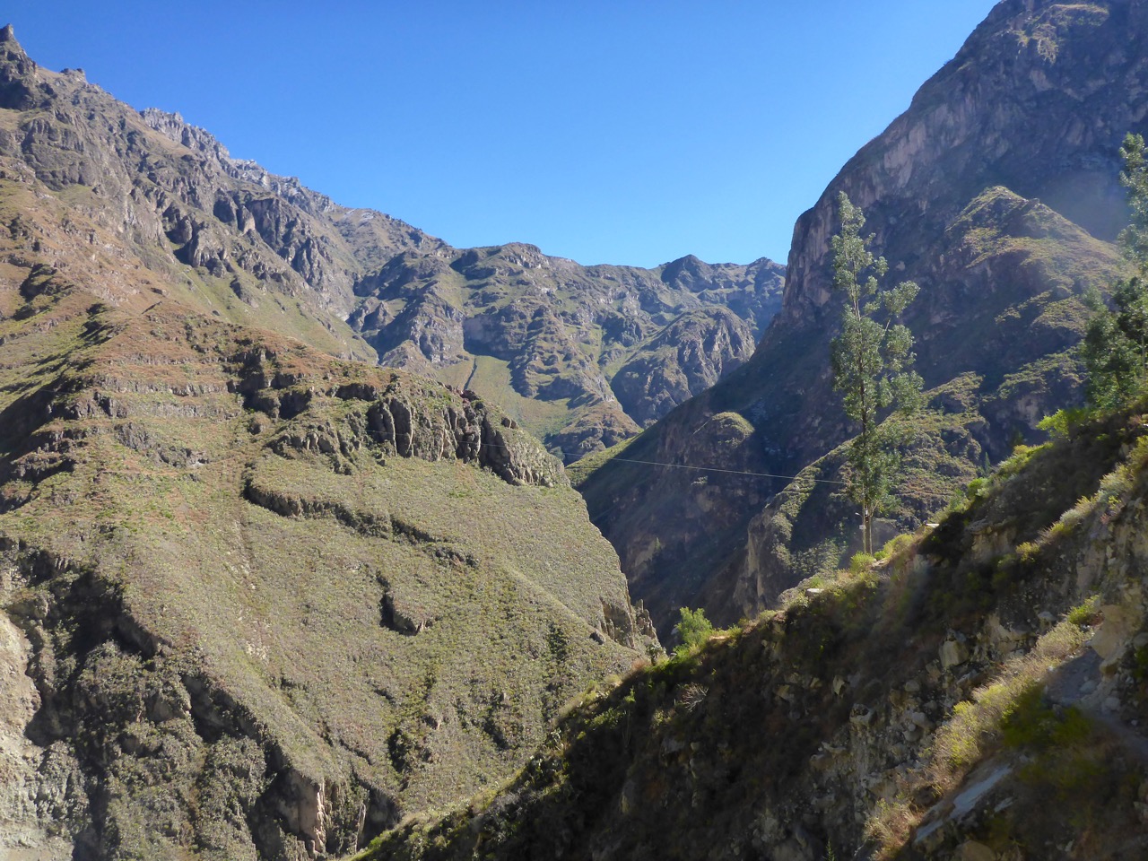
We made great time getting up there, doing it in two hours instead of the five it was supposed to take. As soon as we arrived we realized this was probably not the place to stay – we had been told that locals would offer a room in their house to stay in, but the village (ten houses total) seemed to have been virtually abandoned. We met a woman who was walking her sheep up to graze and had a little house there. We wanted to make the out-and-back hike to the nearby waterfall, and she offered to watch our backpack while we hiked it. The waterfall was beautiful, all of the way back in the canyon. The water just came out of nowhere, from the middle of the rock, shooting out to a 110 foot drop.

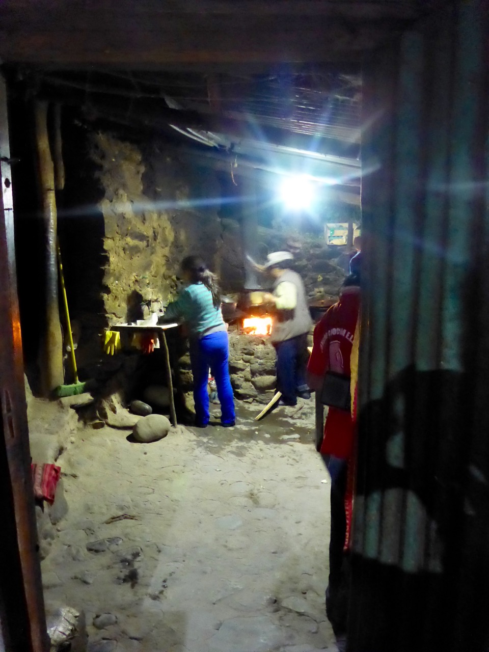
    We planned to eat lunch at the house of the woman keeping our backpack, in exchange for keeping it. But when we asked her about lunch, she said she didn’t have anything to serve and we could go to the shop at the end of town. The shop was most definitely closed, like every other house there. It was supposed to be another solid day’s hike to get to Sangalle, but since we’d made great time in the morning we figured we could make it that afternoon.

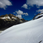
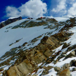
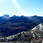
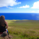
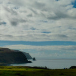
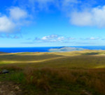
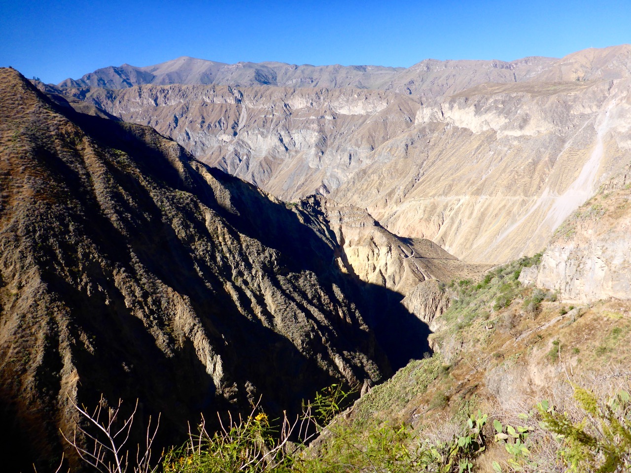
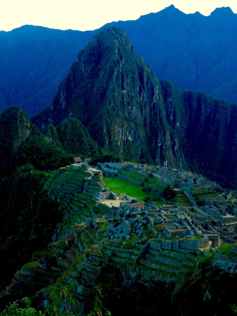
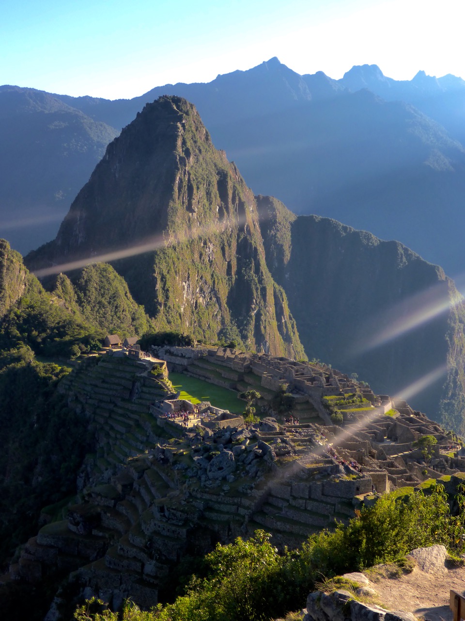
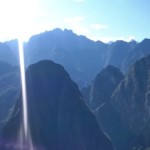
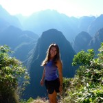
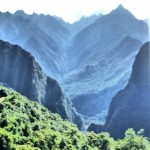
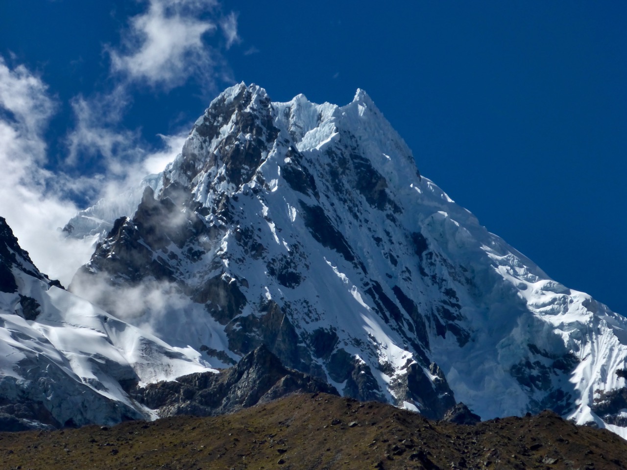
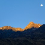
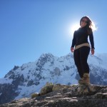
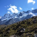
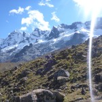
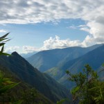
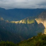
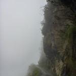
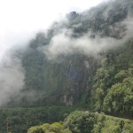
    This section of the hike had some of the best scenery and views of the canyon and surrounding mountains. P1200583

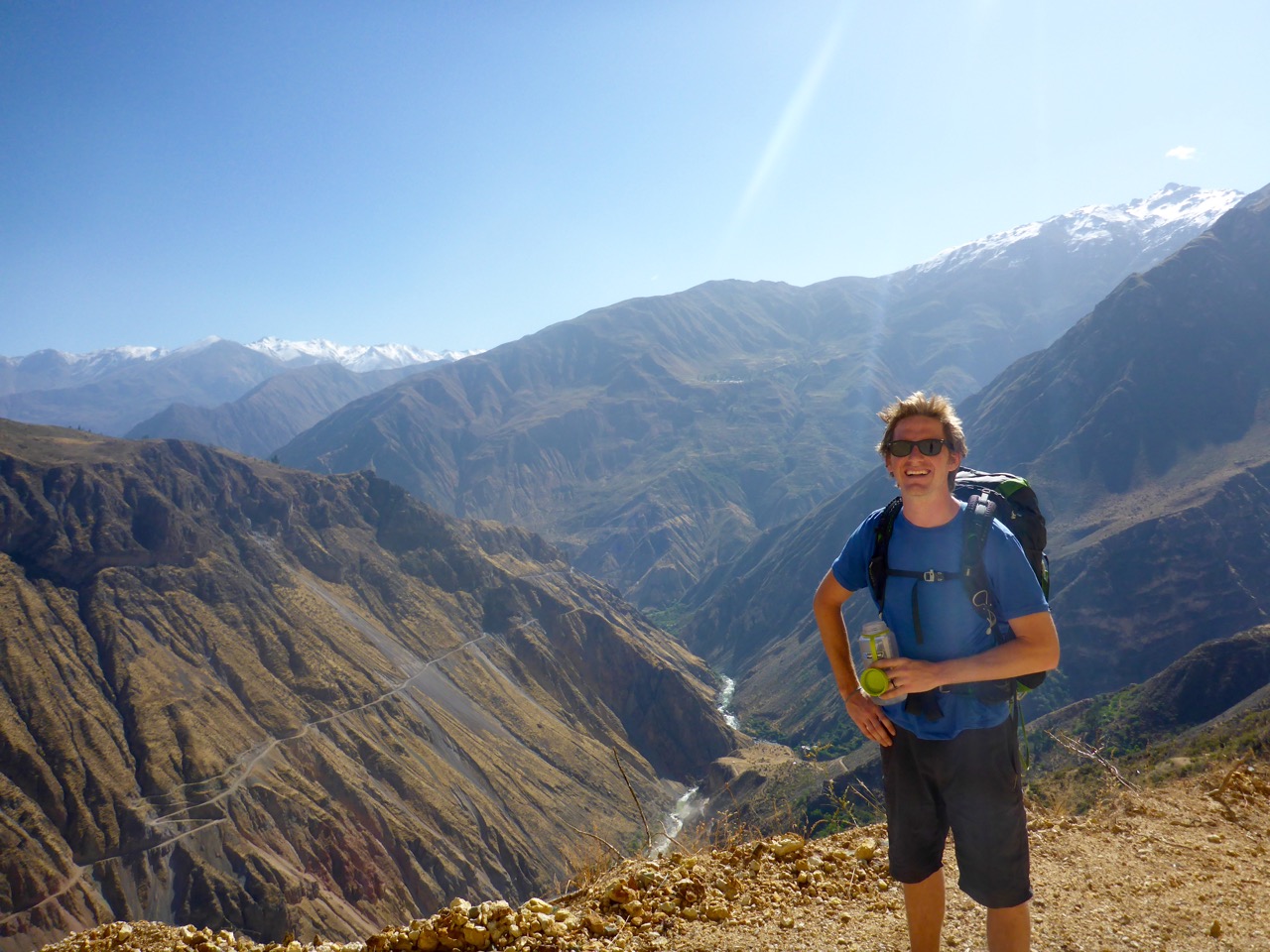
    But the downside was that a large portion was on the dirt road – which always makes it feel like you’re hiking ten times longer than you actually are.

    P1200536

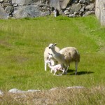
    Today’s hike also had the highlight of us getting the crap scared out of us, and running away from, the least intimidating animals ever. First it was the Attack Sheep of Death. Yes, a sheep scared us. It was perched on a terrace just above the trail and as we got closer, it started stomping it foot, making angry eyes at us and looking like it was going to either ram us, or more likely in my mind, taking a flying attack leap off its perch over us and batter us with ninja-like hoof moves. No kidding, we tried to talk it down but to no avail, this sheep did not want us there… so we covered our heads and ran past it!

     To add further insult to our day, this GIANT fly with a huge proboscis/stinger started following Rick and trying to bite him… which resulted in him flailing our Nalgene at it and then running away. (and I refused to come to his rescue). And the final moment of shame was when a quail surprised Rick on the trail, when he surprised it coming around a corner, and he screamed and hit the deck – I’m sure it was PTSD, Post Traumatic Sheep Disorder, that caused his dramatic reaction.

    P1200600

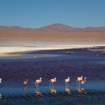
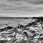
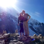
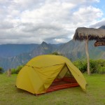
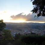
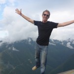
    Anyway, finally “The Oasis” of Sangalle came into view…. All we had left was a 3,000 foot descent into the valley! It wasn’t as knee-busting as we feared, but after putting in about 19 miles that day we were ready for some rest. Sangalle is called “The Oasis” because in the middle of this massive desert canyon, water literally flows from the rocks everywhere there. It’s filled with greenery, palm trees and pools! The pools are filled with constantly flowing natural water. It was really cool.

     P1200601

    We relaxed with a beer and big dinner and went to bed early. We had to wake up at 5:30am the next morning to make our way 3,900 feet up the side of the canyon back to Cabanaconde in time to catch a bus.

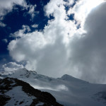
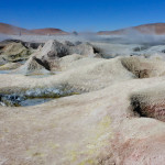
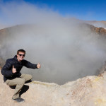
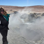
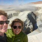
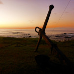
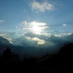
    We were thankful it was still chilly in the morning, because the ascent certainly warmed us up quickly. We made it in just under two hours, about half the time it was supposed to take us – Yea, we still got it! The canyon was really cool with lots of views and volcanic activity – from geysers to hot springs.

    The climb back up the canyon was nothing compared to the nine hour “sightseeing” bus ride back – ugh! We were dirty and exhausted when we got to Arequipa, but since there was no room for us in the hostel we decided to jump on a bus to Lima.


  • Machu Picchu

    Machu Picchu

    After trekking into Aguas Calientes and hearing about the hour and a half hike up the hill from town to Machu Picchu, and knowing that we had to catch our ride back to Cusco in the early afternoon, we decided it made the most sense to just buck-up and pay for the bus ride up the hill. $26 USD apiece round trip… for a 20-minute bus ride. That’s on top of the Park entrance fee and whatever else you spend to get there. Needless to say it’s not a cheap place to visit. #Extortion

    Nonetheless we are up at 5am and waiting in line for the bus when the nice lady comes buy to check our tickets and our passport.

    “Tickets? I know I put them in one of these pockets. Crap! Liz stay inline I’ll run back to the hostel and grab them from the backpack.”

    10 minutes Later I came back and said something like this.

    “I lost them. Explicative. Can’t find them. Explicative. They’re gone. Explicative. They must be in Cusco where we bought them. Explicative.”

    I am officially the loser now.

    Liz stayed calm and said something to the effect of “Calm down and go check and see if they can reprint them in the park office.” I run off to the office is open (amazingly) and they were more than happy to look up my passport number and reprint the tickets for me.

    My heart was still racing the whole bus ride up the hill and for probably an hour after. So once we got into the park it felt a little more like Disneyworld than an ancient city. Hundreds of people everywhere, lines, tour groups with bicycle flags. We wisely made our way away from the hordes of people and followed signs towards “Inca Bridge.” Sounded interesting enough and was the opposite direction of everyone else. We were rewarded with a narrow path build right into a cliff face that worked it’s away around the mountain and then ended at a bridge that appeared to be a defense mechanism. Run across the bridge, remove the boards, enemies are stuck. Pretty cool.

    We spend the rest of the morning wandering around the massive maze-like city. Taking a ton of photos and overall just being awed at their ingenuity and the beauty of the valley.

    P1200309

    We had learned a bit about Inca construction from our walking tour in Cusco so it was cool to see it play out on a grander scale. As with most everywhere else, the more important things are constructed better. The temples and “important places” are constructed in a way that the rocks fit perfectly together, with almost no gap. Where as common houses etc, while still built well, definitely don’t have the same attention to detail. Even still it’s amazing what has stood the test of time. While a lot of Machu Picchu has been reconstructed, with a little wandering we were able to find some areas that hadn’t been rebuild yet, and they’re surprisingly intact for their age.

    It was also pretty amazing seeing how the Incas worked with the landscape. From the dozens of levels of terraces build right into the side of the hill to using the giant boulders in their construction – they really made use of what they had to work with.

    One of the things that we didn’t expect of the sacred valley (though I guess we should have by the name) was just how cool the valley itself is. Machu Picchu sits on this little shoulder between two small peaks on a peninsula in the middle of this valley that is completely surrounded by rows and rows of mountains in every direction. Makes it pretty obvious why the Incas picked this spot for Machu Picchu.

    As we were making our way toward the exit to catch our bus we came across a pair of llamas that had just given birth and got to see a baby llama take it’s first steps on a terrace at Machu Picchu. We felt kinda special.

  • Walk like an Inca: Salcantay!

    Walk like an Inca: Salcantay!

    If you’ve followed this blog for more than a minute or know Liz and I at all you’ll know were not ones to plan things 6 months out. That’s apparently what it takes to hike the “Classic” Inca Trail to Machu Picchu. It’s limited to 500 people a day and books up 6 months in advance… Seriously 500 people a day on a trial. No Thanks.

    Lucky for us there are a number of other ways to get to Machu Picchu some of which even involve hiking. After a lot of option weighing we decided on the Salcantay Trek which follows another of the Inca’s many highways through the Sacred Valley on a 4 day trek and includes a 4600m pass. Best part… you can hike it without a guide and you don’t need tickets!

    Salcantay Trek to Machu Pichu, Peru
    This is Liz’s new favorite mountain, Salcantay.

    After visiting the local South American Explorers club for a topo map from the 60’s (the latest version) and stocking up on a few supplies for the 4 day trip to Aguas Calentes at the base of Machu Pichu we caught a Colectivio at 6am for the ride to Mollepata where we’d start our journey. We were in luck and got the last 2 seats in the jam-packed mini-bus which meant we got to ride in the front and we didn’t have to wait for anyone else. A quick two hours later we were in Mollepata and I suggest we get breakfast as sort of a last meal before oatmeal for days. We got a tourist breakfast, which came with “orange juice” which not surprisingly turn out to be Tang. Liz pointed out that it probably wasn’t made with filtered bottled water… I shrugged her off and downed both glasses. #foreshadowing

    We made our way to the edge of town and up a gravel then dirt road climbing all the way. It was surprisingly hot and when a guy driving past offered us a ride we jump at the opportunity to cut a few minutes off our trek. He drove us for about 10 minutes to where our ways parted and probably saved up 30 minutes of walking in the hot sun. Shortly there after we saw our first, of many, tour groups that were unloading from mini buses and starting their hike. The rest of the first day was a hot up-hill slog with some awesome views.

    After reaching a valley and a huge fancy lodge, we found our campsite, with great views of the surrounding mountains. We were tired and wanted to save our energy for the 800m climb to the pass the following morning. The wind was picking up and it was getting cold as the sun set so we were thankful for the small cooking shelter where we made dinner and met another guy hiking independently, Mark. Mark had been traveling Bolivia and Peru and as we swapped stories he mentioned how he always seemed to get a bout of giardia whenever he’s in the Sacred Valley… #MOREforeshadowing

    We rose with the sun and started our push to the pass at 4600m. The first hour was pretty brutal, our muscles were cold and sore and it took a while to get warmed up, but once we were the trail was beautiful and we found our rhythm.

    At the top of the pass we were pleasantly surprised to find a summit that was enjoyable and a nice place to hang out for a bit. It was down right pleasant, even in a t-shirt. We took some photos, socialized a bit with some of our new friends, and of course found time to do our signature “airplane at the summit” move! We enjoyed the sunny weather before turning our boots downhill.

    After a few hours of downhill I realized I couldn’t suppress it any longer. That rumble in my stomach had grown from “maybe a little gas” to “I think I’m going to poop on myself.” The challenge now was where. Or trail had become a bit of a donkey path with dense vertical jungle to our left and barbed-wire fence and drop off to our right. I decide it’s time to warn Liz of the impending doom.

    Honey, I think I’m going to $#!† myself.

    And so starts the search for the perfect location… make that any location. Did I mention the team of donkeys and porters we had just passed about five minutes ago that are hot on our tail?

    Eventually, as the pressure builds, I get less selective and I find the perfect place to hang off the edge. At this point there is no longer any questions… I should not have drunk the Tang. We hobble into the next campsite about an hour later and Liz enjoys a cold beer with our new friend Mark while I head straight for the bathroom. After about an hour, a dozen trips to the baño, a few Peptos, a prescription strength anti-diarrheal, and a Gatorade, I’m feeling semi-confident I can probably make it 30 minutes down the trail to the next campground where we planned to camp.

    We made it and were greeted with a beautiful site right in the middle of the valley. I collapsed on the ground while Liz set-up the tent, cooked dinner and suggested I take some of the hydration salts she had ever so wisely suggested we carry with us on all hiking trips. After dinner I perked up a bit before feeling a bit ill again and deciding I needed to go to sleep.

    The next morning I felt worlds better and when Liz ask if I was up for the alternate route I was game. It was downhill-ish for the first 3.5 hours until we reached La Playa where the trials split, one climbs 800+m uphill to Llactapata (another set of ruins) and the other down to the tourist town of Santa Teresa and the hot springs. We started uphill at about noon and it was absolutely sweltering. We’d hike for 15 minutes then rest in the shade for 5 but eventually we made it to the top of the mountain and the Llactapata ruins from which you can see Machu Picchu across the valley.

    Our campsite for the night was a few minutes down the trail and had an even better view of Machu Picchu. It was a pretty magical sunset. Then it was up early the next morning for the big walk down the hill and along the train tracks to Machu Pichu Puebo, Aguas Calentes, The tourist town at the base of Machu Picchu. The entire town is basically there to support the tourism of Machu Picchu.

    Salcantay Trek to Machu Pichu, PeruSalcantay Trek to Machu Pichu, Peru

  • Being Bolivian

    Being Bolivian

    Bolivia is known for being a country of extremes – the highest capital, the wildest jungle, some of the poorest people, the most indigenous population. We got to experience the largest salt flats, our highest mountain climb, our longest downhill bike descent, but we enjoyed the people just as much as any of that.

    First off, it’s the first country where the Spanish spoken there was even close to the Spanish I grew up learning (Chilean and Argentine Spanish is very different). Plus it seemed like Bolivians really wanted to communicate, even if my Spanish wasn’t great and Spanish was probably their second language (Quechua is many people’s primary language), so many strangers went out of their way to communicate with us.

    After the salt flats and the silver mine, we made our way to Sucre. Sucre is known as The White City because of it’s gorgeous all white colonial architecture.

    As soon as you arrive there, it’s feels like you’re at home there. It’s smaller and calmer than the addictive, high altitude madness of La Paz. I wish we could have stayed there longer. Sucre is known for language tourism now – so you go there to take Spanish classes or lessons, and they’re super cheap.

    We laid low most of the time in Sucre, just wandering the city, or getting our 14 Boliviano (less than $2) lunches at the market and talking to the people selling produce, cakes and meat.

    We did go on one hike there. It was a bit of a failed hike… after taking a public minibus to the end of the line, we followed directions from some kids playing in the dirt. We ended up seeing a really cool canyon and some small waterfalls, but we later learned that either we didn’t go far enough or went the wrong direction and missed the seven waterfalls we were supposed to see.

    hiking around sucre, bolivia

    After Sucre, we made the overnight bus ride to La Paz that goes through 16,000 ft mountain passes. Sleep was pretty much hopeless at that altitude and on those turns. So we arrived in La Paz a bit disoriented, blurry eyed and out of breath (from the altitude), but managed to find a hostel pretty quickly. We noticed a lot of excitement going on outside our hostel and set off to explore what was going on. We quickly found ourselves in the middle of a parade. But this isn’t your standard American 8am-11am parade… no… this is an all out, put Mardi Gras to shame, all-day-all-night parade. And we were there just in time to get a seat.

    The costumes were unbelievable. The music was infectious. We were sucked into the spirit of Gran Poder immediately.

    We hung out with new Bolivian friends and celebrated until late in the evening, but we bowed out well before the festivities ended around 3am.

    Because Bolivia has the highest percentage of indigenous people and many continue living out their traditions, the clothing in Bolivia is very striking. First off, HATS! Hats, hats and more hats. Of all shapes and sizes, but my favorites were the bowler style hats worn by women on the very tip top of their heads.

    Bolvian women in hats

    We spent one of our days in La Paz being typical tourists and did a bike trip down “The Deadliest Road in the World”. While it is still the same dirt and rock road with hairpin turns and steep drop-offs of thousands of feet, it’s much less dangerous now because most traffic takes the new road, at least that what I tell myself as we ride down. It’s the 18-wheelers and crazy drivers, combined with the roads characteristics that made it truly the deadliest road. Now it’s slightly safer, but as beautiful as ever. We went with a group of about five others for a 64km downhill ride and “survived.”

    And of course we spent some time browsing through the Witches Market. You read that right, a market for witches. Need a remedy for that rash? A good luck charm to help to find the love of your life? This little block of stores selling all kinds of herbs, oils and amulets and… llama fetuses. Yep dried unborn baby llamas; from little tiny to practically huge. The llamas are used by locals to bring good luck to their home, by burning them and burring the ashes under their house.

    And before we left La Paz we tackled Huayna Potosí.

  • Livin’ Large and Hangin’ with Street Dogs

    Livin’ Large and Hangin’ with Street Dogs

    Santiago, Chile is a really underrated city on the travel circuit. We went there expecting nothing more than a big city, but were surprised with the culture, Euro-style beauty and awesome food.

    Cerro Santa Lucía, Santiago, Chile
    Cerro Santa Lucía, Santiago, Chile

    We were coming from our Workaway job in the Colchagua Valley where we had been off-the-grid for a month. We stayed in a nice, but rustic volunteer cabin there shared with the two other volunteers, and before that we had been doing a bunch of hiking and camping, so it had been a while since we had hotel night. Some incredibly generous and thoughtful friends gave us a Marriott gift card as a going away present, very wisely saying “after a few months in hostels and camping, you’ll enjoy this more than you’ve ever enjoyed a hotel before”. Smart folks!P1150086

    So we booked the brand new Marriott hotel in Santiago, in the posh-est part of town. Of course, arriving as dirty backpackers gets some strange looks, but they took great care of us.

    guy light
    Even the lamps seemed to say “At your service.”

    We grabbed pisco sours on the rooftop bar overlooking the Andes and took advantage of the gym, sauna and hot tub.

    We weren’t done with being high rollers though!! Rick knows my foodie tendency and had researched a list of the best restaurants globally. Some were clearly out of our price and attire range (I’m looking at you, Europe!), but Santiago had one of the top 50 in the world that fit us just right. I thought there was no way we could get a reservation on such short notice, but Rick worked his magic and with the help of an in-the-know concierge, who incidentally dubbed us “Very Important International Guests of the Marriott”, we got a table. There are only eight tables in the restaurant, one seating per night.P1150132

    We arrived at Boragó and were immediately wowed by the attentive staff and open kitchen. The restaurant is all based on using ingredients endemic to Chile, especially little known ingredients, and creating dishes that highlight those natural flavors. If you haven’t noticed, and I really didn’t until I rode buses the full length of it, Chile is a HUGE country. It stretches most of the length of South America and is extraordinarily diverse.

    Of course we went big and did the fifteen or so course tasting with wine pairings, and it was out of this world! Each and every course was a visual work of art, told a beautiful story (which was explained to us by the chef each time he brought food out), and tasted incredible.

    Its hard to choose a favorite, but a couple of our top picks were the Jaiba crab with flakes from natural sea rock minerals, the veal cooked in milk, and the sheep’s milk dessert. The wine pairings were incredible as well. In fact, the Viognier was so good it got us hooked on the varietal and it’s been our go-to wine if we can find it for the last month. It was Laurent Zaphire Viognier 2013 from Maipo. If you find a Viognier from Chile, it’s definitely worth getting a bottle– and telling us where you found it!

    P1150242
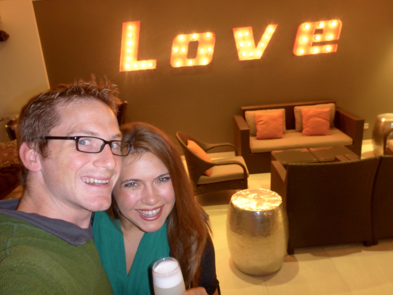
So after spoiling ourselves for a day, we returned to our backpacker ways and headed to a hostel to use as a home base for exploring the city. (Turns out when you have a nice hotel for the first time in months, you don’t really want to leave the hotel AT ALL. We just used high speed internet, took hot showers, inhaled the smell of a clean room.)

    P1150247Santiago has beautiful parks running through out the city where everyone strolls. On Sundays they even close down the huge main avenue so everyone can bike, rollerblade and run on it. We decided to take the free walking tour of the city that was offered. As usual we were running late to meet get to the meeting point, so we were power-walking/jogging through streets to get there. Out of no where this little black dog spots us from across the street, I swear he made eye contact with me for two seconds, then decided we were his new best friends. We kept going at our power-pace, but undeterred he kept up. I joked to Rick that the dog had made quite a mistake because we were headed off to a five hour walking tour, Rick quipped something like “well bud, if you make it all five hours with us I’ll buy ya a Super Pancho (hotdog)” …you can see where this is going.

    P1150280Without us talking to the dog, petting him or anything else, the little guy proceeded to follow us to the meeting point, and then continue on the ENTIRE walking tour. We would go in museums for twenty minutes and he would just wait outside for us. Other stray dogs would run up and bark at him, like “this isn’t your turf”, and he would just take a short cut through an alley and pop back out beside us. He soon became the mascot of our walking tour. And all of our pictures of Santiago landmarks have our little stray friend in them.

    We learned that Santiago-ians have a soft spot for stray dogs. As fall comes and it starts to get cooler, people dress the stray dogs in dog jackets, modified sweatshirts and anything else to keep them warm. They also volunteer to build doghouses to go in the parks so the dogs have somewhere to sleep. We learned that there is a long history of the stray dogs being “the people’s dogs”. When Chile was going through a lot of political turmoil and there were frequent, sometimes violent protests, the street dogs always took the side of the protestors. The military and police would have their riot shields, pepper spray and water hoses, and the street dogs would line up with the protestors and go crazy barking at the police. So don’t mess with Santiago’s street dogs, they are well loved.

    At the end of the afternoon, Rick was good on his word and we bought our friend a hot dog. We finally had to sad goodbye to him at the seafood market… despite his best efforts, they just don’t allow dogs in there.

    Fish Market Central, Santiago Chile

    Rick was not surprised at all by the whole thing, as I’ve attracted street dogs all over the world. I think it’s Ruger sending out some signal to all his canine network that I’m a dog person. The street dog will take one look at me (while I’m intentionally NOT looking at him), and decide I’m his new best friend.

    From a top 50 restaurant to street dogs, our time in Santiago was never dull and always beautiful.

  • Climbing Huayna Potosí

    Climbing Huayna Potosí

    Huayna (pronounced Why-Na) Potosí hits 6088 meters (that’s 19,980 feet!) above sea level in the Cordillera Real, about 2 hours outside of La Paz. It’s considered by many to be the first technical mountain above 6000m that most people will ever climb. That seemed like a good enough reason for us to try and tackle it. With La Paz acting as a base camp of sorts for acclimatization at almost 3500m it’s only a 3 day trek to the top. With this being our first technical climb, we went with a guide.Huayna Potosí

    After meeting our Guide we went by the Altitude6000 depot to get outfitted with a few things we didn’t bring on the trip, specifically mountaineering boots, ice axes and crampons! Unfortunately I had sold my crampons in a garage sale before we left – you know, since I only got to use them on one trip down the drive way in Dallas during an ice storm.

    Llamas on the way to Huayna Potosí

    After driving up to base camp at 4700m we ate lunch and then took a short hike to Glacier Viejo to familiarize ourselves with our gear. This turned out to be more like an Ice Climbing 101 class and was awesome. Liz was a natural.

    The next day we hiked up to high camp at 5130m with all our gear. After reaching high camp we dropped our gear, ate lunch and then climbed a little higher to try and help us acclimatize a little more. Then it was rest, rest and rest the rest of the afternoon; We would be waking up at midnight for our six-seven hour push to the summit.

    With a full moon and headlamps we strapped on our crampons and started up the mountain. Huayna Potosí doesn’t mess around. It starts off steep right out of high camp and didn’t let up. As we climbed we were entertained by cloud-to-cloud lightening off in the distance. It’s something else to see lightening when you’re eye level with the clouds.

    We got to practice our newly acquired ice climbing skills in the dark on a 15m wall that marked the halfway point.

    From here on out it seemed like every step was twice as hard as the previous. Our guide was a huge help at this point as he was constantly motivating us to keep slowly moving up the mountain. After our Kilimanjaro experience we we’re to big on racing up the hill and were more than happy to the few other teams on the mountain pass us up. The only prize for getting to the top first is that it’s still dark and freezing cold!

    Climbing Huayna Potosí

    As the sun started to peak over the horizon we could see the summit with in reach and that was just the encouragement we needed for our final push.

    The summit was glorious… and tiny. I mean just enough room for the three of us, which made us thankful we were the last one to summit as there was no one to rush us off for their photo opp. We hugged, danced, cheered and took a couple of sips of our celebratory cervezas and attempted our now signature “Airplane” move only to realize it was going to take a lot more practice before we can do it with crampons. We made to the highest we’d ever been – 19,980 feet – just 20 feet short of 20,000 FEET!

  • The Silver Mines of Potosí, Bolivia

    The Silver Mines of Potosí, Bolivia

    Silver Mines of Potosi, Bolivia

    After the Spanish conquistadors made their way to South America the silver mines of Potosí, Bolivia floated the Spanish economy for over 200 years. Now thousands of Bolivian men (women are bad luck in a mine) support their families in the free-for-all that the mines have become. The mining rights are extremely loss and when mine shafts cross they often result in physical fights over who owns what. The labor is extremely physical and life expectancy for many of the jobs in the mine is 10 years. That being said, we jumped at the opportunity to go into the mine with an ex-miner.

    After dawning some “protective” clothing, helmets and a headlamps, we went to the miners market for coca, dynamite and some 96% alcohol, a miner favorite; all gifts for the miners we would be visiting. Chewing coca leaves is supposed to help with the altitude, low oxygen levels, as well as increasing alertness among other things. The alcohol is basically cheap Everclear, which is a lot easier to carry hundreds of into the mine than a case of beer (though we saw plenty of beer cans inside as well). And the dynamite… it’s for blowing things up.

    Inside the mine was a labyrinth of tunnels, ladders, shoots and rails all to extract every last mineral in the mine. It went from dark and cold, to dark and steamy, to dark and dusty.

    Silver Mines of Potosi, Bolivia

    Our guide, who’s father still worked in the mine, kept us from getting lost as he gave us some of the history of the Potosí mines. One of the interesting stories was how he explained the religious beliefs of many of the miners. When Christian missionaries came to South America, they introduced the miners to Jesus and the devil… which the minors add to their list of things to worship. Inside the mines to can find many alters to both Jesus and Tios (a mispronunciation of of dios, the Spanish word for god) who is a form of the devil. They miners figured the closer to hell they got the more they should ask Tios for protection as they are taking minerals from his realm. To thank him they leave him thinks he likes, alcohol, coca leaves etc. though they leave the similar gifts on the Jesus alters… it’s a little confusing to say the least.

  • Uyuni Salt Flats and the Atacama Desert

    Uyuni Salt Flats and the Atacama Desert

    After a 24 Hour bus ride from Santiago we arrived in San Pedro de Atacama, Chile, the “Driest Place on Earth.” It definitely lives up to the title. It’s a pretty surreal landscape and it’s hard to believe anything lives out here, much less people. But as we strolled through the streets of San Pedro we were struck with how charming of a little town it was. All the little café’s and restaurants have little fire pits in their courtyards… did we mention it was cold? Sitting at about 8,000 feet it’s pretty stinking cold, especially once the sun goes down.

    San Pedro de Atacama

    The next day we made our plans for our Salt Flats trip, I was extremely excited to see them so we didn’t plan to spend much time in San Pedro. We took an afternoon tour out to the Moon Valley and the Valley of Death/Mars.

    It was a pretty cool to see all the crazy landscapes out here, with crazy rock and salt formations that look the surface of the moon or Mars, which lend their names of the valleys.

    Salt just leaches out of the ground here and looks like snow at a distance. We got to go into a cave made almost exclusively of slat. Yes. I licked the wall to check.

    San Pedro de Atacama

    We got to see the Salvador Dali mountains, named after the way the looked like, well, a Salvador Dali painting.

    Dali Mountains

    And finished the evening with a private photo shoot on Coyote Rock… ok maybe not so private.

    The next morning we packed everything up and meet our mini bus at dawn for a 3 day trip to Uyuni via the altoplano and salt flats. The altoplano is kinda like the high plains in the states… but a lot higher… and there are volcano’s… and geysers… and flamingos… so maybe not so much like the states.

    Chile - Bolivia Border

    Our first stop was at the Chile-Bolivia border where we leave our mini-bus, go through “immigration” and meet our 4×4 driver/guide for the rest of our trip. The border crossing is on a pass about 14,000 feet up. It’s super windy and freezing cold. Never have I seen so many Land Cruisers in one spot. All loaded up with 100 extra gallons of gasoline and a couple of spare tires, not the kind of place to want to get stuck.

    At the border we needed to pay $USD 60 a person for 30 day visas to Bolivia and due to a slight banking error on my part (it takes a few days to move money from account to account as a safe guard against being robbed) we were down to our last few bucks, but we had just enough with a few Chilean Pesos to spare. We filled out our paper work and handed it to the Border Patrol with our money. He hold the 100 up to the light, verify it’s legitimacy then does the same to the 20, stops puts it in my face and flicks the edge where a tiny nick was and says “No.”
    I say “what?”
    He flicks it again, closer to my face and says “NO!”
    I try to explain in broken Spanish that I don’t have any other bills that’s all I’ve got to which he replies “Then you no enter Bolivia” and takes our papers and throws them behind a desk.
    I. Freak. Out. And kinda storm out of the little building not sure what to do, but sure we be stuck freezing to death outside with no where to go.

    After Liz calms me down a little, a nice Chilean lady who is in our group understands what’s going on and starts trying to find me a good bill; she’s asking everyone. Eventually she finds a little old lady that I’m sure here only reason being there was to give horrible exchange rates to desperate gringos like me on the last pesos I had which was just enough. After some apologies and pleading and digging papers out of the trash, we paid our way into Bolivia in Dollars and Boliviano (no change of course) and were probably the lasts ones to leave the border.

    From there it was all uphill… literally. Our little Land Cruiser climbed and climbed until we reached so of the most remote, desolate and beautiful landscapes on the planet.

    We were pleasantly surprised to find hot springs at about 15,500 feet and enjoyed a steamy dip before going up another 1000 feet to the geysers. Steamy, bubbly mud holes with a broken English warner from our driver, “No fall in!”

    With the smell of sulfur firmly attached to our clothing we made our way to Laguna Colorada, a brilliant red lagoon with flamingos just waiting to pose. I always thought of Flamingos as tropical birds, but here they are wadding through the water at 14,000 feet while we freeze to death.

    It was gorgeous and unreal then it was on to another lagoon and to our camp for the evening and some hot cups of coca tea.

    Altoplano Atacama Bolivia

    The next day was just as unreal, full climbing all over unbelievable rock formations and the discover of a new to us plant called, loosely, green rock. A crazy plant that looks like moss, is hard as a rock, and has a slight sap that make your hands sticky if you touch it.

    Our accommodations for the evening were on the edge of the Uyuni Salt Flats at the Salt Hotel… literally the whole thing is made of salt. Even the chandeliers.

    Salt Hotel, Uyni, Bolivia

    We awoke EARLY to drive out to the saguaro cactus island in the middle of the salt flats to catch sunrise.

    The rest of the day was basically a never end forced perspective photo shoot on a never-ending backdrop.

    And then Liz taught me how to levitate.

    Levitating Uyuni Slat Flats, Bolivia

    We concluded our tour with a trip to the Train Graveyard on the edge of Uyuni, Bolivia where all good Bolivian trains go to die… and then be cut up for scrape metal.

    Uyuni Salt Flats, Bolivia

  • Everything you know about Easter Island is probably wrong.

    Everything you know about Easter Island is probably wrong.

    Rapa Nui Moai on Easter Island

    At least it was for me… A mysterious civilization who built massive statues and suddenly, unexplainably vanished from existence, right? And those statues were of giant faces on hillsides looking out at the ocean, right?

    Wrong. And. Wrong.

    I had pretty low expectations for Easter Island, thinking it was going to be over touristed and a little too much on the archeology nerd (Rick) slant. Especially for spending five days on the most remote place on earth – at 2,300 mile from Chile, and 2,500 miles from Tahiti, it’s out there on its own. But Easter Island, or Isla de Pascua as it’s called in Chile, or Rapa Nui as its called by the native people, blew my expectations out of the water (pun intended… Volcanic island, get it?)

    Pretty much everything I knew was wrong, but here are my five favorites.

    1) Myth: The civilization that created the incredible and huge stone sculptures (called Moai) became extinct and nobody knows why.

    Rapa Nui Moai on Easter Island at Sunset

    Agostin Trip Truth: Nope, definitely not an extinct society. The society is the Rapa Nui people. And I met and hung out with a lot of them! So I’m not sure what scientist has gotten that fact screwed up. And when I asked my Rapa Nui friend about how she doesn’t exist, she laughed good heartedly as she’s heard it before, but was floored! Rapa Nui are awesome, everyone we met was kind and super funny, and felt much more Polynesian than any South American people. So there ya have it – Easter Islands ancient people are not extinct. And here’s the picture to prove it!

    2) Myth: …and this population went extinct because of poor resource management – like cutting down all of the trees to build more statues, not taking care of the land in this race to build more statues.

    Easter Island

    Agostin Trip Truth: again… “I’m not dead yet!” So while the society still exists, there have been a lot of changes, as there would be in any society. They don’t build the Moai any more. But the reason isn’t a lack of resources, it’s that their ancestral beliefs changed from mainly worshipping the giant stone images of their important ancestors, to worshipping Birdman and the power he brought. Every year there was a contest to see who would be the Birdman for the year and be the supreme ruler/deity which involved swimming to a island and climbing up rock walls to find bird eggs.

    And after Birdman came tribal fighting across the island and the catholic missionaries. We went on a couple tours of the island and saw how these changed beliefs were acted out completely differently and in different areas leading to a change in priorities.

    3) Myth: These infamous, super photographed, NatGeo cover statues are hundreds of giant faces on hillsides looking out at the ocean.

    Rapa Nui Moai on Easter Island

    Agostin Trip Truth: The Moai are actually full body statues of a specific ancestor. They were made in quarries in the middle of the island, but they had to be transported by the family to the coastline nearest where the family lived. They would have a ceremony which brought the Moai to life so it could protect the family, bring them good crops, many children, all that stuff. It always had to face the family, and drew power from the sea behind it. TOKHAHI It turns out the most frequently photographed couple of Moai are a couple of unfinished ones that were still being carved when the carver quit so they still sit on the quarry. But honestly I think these are still my favorites. We rented a vehicle with a friend for a day to drive around the island and got really fortunate to be the last people of the day in the park with these Moai. It was magical, you could feel yourself being pulled back in time.

    Rapa Nui Moai on Easter Island

    4) Myth: Most of the statues are still standing. Those that aren’t were victims of a great war for resources between the Rapa Nui.

    Rapa Nui Moai on Easter Island

    Agostin Trip Truth: actually every single statue on the island was knocked over and broken. In the last 20-50 years about two dozen of the hundreds have been put back up. The Rapa Nui people just didn’t believe in the Moai any more, there was this new Birdman dude on the scene, so if a tsunami hit them, no big deal, or if they were a causality in a war between families, not worth fixing. But the biggest downfall of any remaining was colonization. Various European countries started “discovering” Easter Island. In these visits they would take proportionally huge numbers of slaves back to their South American colonies or Europe (decimating the Rapa Nui population), take the women as their own and bring disease. The Rapa Nui began to see that the biggest point of interest bringing these Europeans to the island was the Moai. So the Rapa Nui tore down all remaining statues, hoping this would keep away the looters of their island. This is relatively recent history folks, like late 1800 early 1900’s.

    Rapa Nui Moai on Easter Island at Sunset

    5) Myth: The statues are the coolest thing on the island.

    Rapa Nui Moai on Easter Island at Sunset

    Agostin Trip Truth: (ok, warning, this one may be rather biased) Easter Island is lush and green with rolling hills that flow into deep sapphire water with powerful waves. And it’s the perfect home for the islands 4,000+ wild horses!! HORSE ANAKEEMA VID Get your head wrapped around that, 63 square miles and 4,000 wild horses, not counting the domesticated ones. They are absolutely beautiful and everywhere… In town, at the historic sites, running across meadows, on the beaches.


    Being in such a horsey place, I could resist going horseback riding. We enjoyed a spectacular ride up to the highest point of the island, and could see the entire island and the ocean all the way around. I got to gallop through lush fields next to the wild horses, and into eucalyptus forests, and up to a volcano crater.

    Well I’m out of myths, but here are a couple other highlights from our trip to Easter Island:

    Walking around town we ran into a local fisherman with his catch from the night before and it looked so amazing we couldn’t pass it up, even through we were camping at a hostel and would have to prepare it there. The first day was beautiful red snapper. It became our ritual and we scored an incredible piece of fresh off the boat tuna, and another time a buttery local fish I can’t remember the name of. All excellent.

    Things weren’t cheap on the island, so it necessitated that we camped while there. We got to camp in this grassy patch right by where the waves crash into the volcanic rock formations. Waking up to that view and going to sleep to that sound was fantastic.

    Easter Island is an incredible little triangle of bliss. Interesting, relaxing, authentic. Not touristed out like you’d imagine. And know I have a completely different idea of the society there, it’s people then and now as well as the Rapa Nui story!

  • Valparaiso

    Valparaiso

    Graffiti art of Valparaiso, Chile

    Valparaiso… What a town; a truly immersive, intriguing and inspirational visual experience especially for a designer like myself! At one point it was the main port for Chile, built into the foothill of the Andes only a couple hours bus ride west of Santiago. The town is a labyrinth of walkways, funiculars, stairs, and dead end streets that wind their way up and down the hills. It’s like something out of Shoots and Ladders and a nightmare for fire fighters where many of the houses aren’t accessible by cars, or streets for that matter. But it’s also full of cute cafes, good food, and interesting architecture.

    Graffiti art of Valparaiso, Chile

    Valparaiso, Chile


    Originally, all the houses were painted different bright colors so the sailors could see their house for the sea. A few revolutions, an economic down turn and less reliance on the port and now it’s turned it into a creative hot bed…. Especially for graffiti artists. The verdict is still out on if it’s legal; some are commissioned by property owners and some are just vandalism. The verdict is also still out on if it’s good for Valparaiso; some say it’s destroying the history, while others say it’s the progression of Valpo’s culture. All things considered there’s no denying that it’s amazing.